Chattooga River - Iron Bridge
Highlights
- Beautiful and Nationally Designated "Wild & Scenic Chattooga River"
- Crystal Clear water
- Above bridge is designated "Wild Trout" waters, single-hook, artificial bait only, 7 inch minimum length, 4 fish limit
- Below bridge is designated "Wild Natural Bait" waters, single-hook, live-natural bait allowed (exept fish), 7 inch minimum, 4 fish limit
- No Closed Season
- River is dominated by a nice population of Brown & Rainbow Trout
- Please note some areas above the bridge are "unfishable" and can be dangerous
- Rating of 6 meaning good access at the "Iron Bridge" area and a good but challenging chance to catch wild trout if patient enough
The Local Scoop
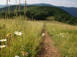
The Chattooga River just outside of Highlands NC is a great Wild Trout stream with Brown Trout and Rainbow Trout dominating the fish population. You have a nice chance at hooking a large Brown in this river, if you're patient enough. This river was also designated as a "Wild & Scenic River" by Congress in 1974. We recommend the Iron Bridge Access to those fishermen looking to head up stream on the Chattooga. This water is designated "Wild" and the use of single-hook artificial bait only. If you are a fly-fisherman then this river is ideal for you. Most of the river is wide enough for a number of casts. The Chattooga River Cliffs Trail follows the river up stream for approx. 4-5 miles where it leaves the river, gains elevation and comes out on Whiteside Cove Road. The total distance from Iron Bridge to Whiteside Cove Road is approx. 6.25 miles. I would like to note that some spots on this river are very dangerous and are extremely difficult if not impossible to navigate past. I have had to crawl on my hands and knees to just find the trail again. Nevertheless these spots took me to some gorgeous areas on the river that are unlike any other in our area. Use the trail to go in and access the river and we suggest walking at least a mile in before starting, especially in the Summer months due to other folks splashing around in the pools and lounging on sand bars closer to the Iron Bridge. There is a campsite located close to the Iron Bridge (on the paved side or "Highlands side") located on the Right hand side and just off of Bull Pen Road after you go over the Bridge and are heading towards Highlands. This would make a nice basecamp for the night if you find it unoccupied. No fee, first come first serve. Also, Ammons Branch Campground is located 2 miles past the Iron Bridge on the Left (see Ammons Branch Campground's page under Stay/Campgrounds).
The Local Directions
From main intersection of U.S. Hwy-64/ N.C. Hwy-28 in Highlands, NC drive through main street until the road turns into Horse Cove Road (just past Mtn. Fresh Grocery on your Right). Drive for 4.5 miles until you come to a fork in the road at a Brown mileage sign. Take the Right onto "Bull Pen Rd." and travel for 3 miles to the Chattooga River and Iron Bridge. There is parking along the roadside and at the bridge.
- Coordinates
- 35.01599, -83.12634
- Address
Highlands, NC 28734- County
- Macon County
- City
- Highlands


