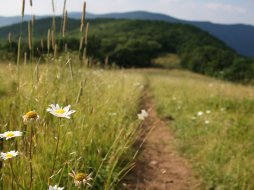
Big Green Mountain Summit
Categories: Hiking & Backpacking
Highlights
- 4200 ft. elevation
- Sheer granite cliffs of up to 300 ft.
- Rare and endangered plant life
- Views of the valley below, Salt Rock Gap, Black Rock Mtn
- Majority of hike is relatively flat from West Entrance Parking
- Primitive Camping at shelter along the trail
- Pack a small towel and change of socks/clothes for the creek "ford"
- Multiple hiking, camping, fishing and exploring opportunities nearby
The Local Scoop
We recommend Big Green Mountain Summit and hike to those whom are looking for a well rounded but challenging hike. Along this hike you will climb down into the valley from the West parking area past Salt Rock Gap on your Left (stop and take in the views and picture opp.). As you work your way down hill you will intersect Deep Gap Trail #449 on the Right in just a few minutes. Take a Right here for approx. ten minutes (avoiding small side trails) until you come to another intersecting trail below you and to the Left. Take the Left (and down hill) onto the Granny Burrell Falls Trail #486. Continue down to Panthertown Creek which you wiil need to "ford" or cross. There is no bridge here but the water isn't very deep. Continue straight avoiding the connector trail to Granny Burrell Falls on your Left. You should pass a shelter. You are now on the Great Wall Trail #489. This trail is practically straight and takes you between the sheer cliffs of Big Green Mountain to your Left and Panthertown Creek to your Right for 0.9 mile to where the trail turns Left and starts the strenous section of the trail for neary 0.5 mile. Here you will intersect the Big Green Trail #487 and take a Left on it towards the summit. Continue another 0.65 mile to the actual summit and end of the trail. Note: Just like any other trail in the Panthertown Valley Area, pay attention to the MAIN trails and avoid any side trails. If you wonder off on a side trail you will run the risk of getting lost. To return back to the parking area simply backtrack the way you came in. This area offers many different exploration opportunities so we suggest visiting our PDF downloads section of the site for our recommendations for day trips to this area. You can modify this hike depending upon how much time you have to spend by reviewing the maps we provide and detailed directions to the other POI's within the Valley. Modifications could possibly include viewing up to three waterfalls either along the way in or on the way out. The last time I was here the information kiosk at the parking area had a map for you to review and the trail #'s mentioned here should correspond with the ones you will find there. NOTE: We recommend researching the Panthertown Valley area before coming and also suggest not coming by yourself or without a map. This area is "wild" and the trail system is unmarked, you can get lost very easily if you don't know where you're going. Our best suggestion is to download and print the map we provide on this site, find the trail(s) you are interested in and plan out your day accordingly. You need to avoid any side trails you come across (and you'll come across a lot of them).
The Local Directions
From the main intersection of U.S. Hwy 64 and N.C. Hwy 107 in Cashiers, N.C. take Hwy 64 East (towards Brevard) for 2 miles to "Cedar Creek Road" on your Left (crossing the Horsepasture River). Take Cedar Creek Road for 2.3 miles to "Breedlove Road" (S.R. 1121 or "State Road") on your Right. There will be a sign for Panthertown Valley at the Stop Sign. Take the Right and travel 3.3 miles to the end of the pavement for Breedlove Rd and where the rough, gravel road begins. You can either park here (if you have a low or nicer car) or you can proceed on rough gravel/mud road to main parking area at entrance to the valley. After you reach the main parking area (via foot- 10 minute walk OR car- 0.25 mile) you'll come to an Info Kiosk with a map of the valley in it and a gate across the trailhead. Be sure to take a look at the map and correspond the trails and their #'s with the ones in my local scoop. Finding Panthertown Valley Trail #474 (West), Deep Gap Trail #449, Granny Burrell Falls Trail #486, Great Wall Trail #489 and finally Big Green Trail #487. Return to the parking area the same way you hiked in or if you feel confident enough to modify your route to view other waterfalls in the area, we recommend having a copy of the area map or have a gps system with you.
- Coordinates
- 35.15871, -83.02764
- County
- Jackson County
- Hike Distance
- 3.1 miles (one-way)
- Access
- Difficult via West Parking Area for Panthertown Valley
- Nearest City
- Cashiers
- Distance From
- Cashiers, 10.7 miles (West Parking Area for Panthertown Valley)


