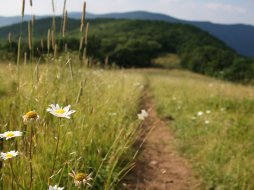
Bradley Fork Trail
Categories: Play, Hiking & Backpacking, Horseback Riding, Places of Interest, Fishing for Wild Trout, Back Country Horse Trails, Great Smoky Mountains National Park... NC
Highlights
- Popular Great Smoky Mountain stream for wild trout fishing
- Easy access with trailhead starting at the back of Smokemont Campground (see campground map)
- Trail follows the fork on the right side via old logging road
- This area was used for a logging community in the early 1900's
- Backcountry campsite #50 via Chasteen Creek Trail, 1.3 miles from trail head
- This trail doubles as a horse trail
- If you are just hiking, we recommend hiking to where the Chasteen Creek Trail and Bradley Fork Trail intersect and returning
- If you are fishing, we recommend you hike up to where Chasteen Creek joins Bradley Fork, at least, if not further
- Horseback riders should know that you can ride all the way to the "AT" near "Charlie's Bunion" via the "Dry Sluice Gap Trail" or access one of the multiple side trails (Chasteen Creek Trail, Hughes Ridge Trail, Cabin Flats Trail, Grassy Branch Trail or Kephart Prong Trail)
Description
The Local Scoop
The Bradley Fork Trail offers multiple activities and uses for you to take advantage of including: Hiking, Fishing, Horseback Riding and Backcountry Camping. We recommend this trail to Hikers looking for a nice backcountry adventure with 4 backcountry campsites (all located off the trail on side trails) with the most popular one being #50 which requires a reservation through the National Park Service. Number 50 is approx. 1.3 miles from the trail head and located on the Chasteen Creek Trail, with relatively easy/moderate access. We also recommend this trail to folks camping at Smokemont Campground due to the easy access from the back of Loop D within the campground. Hike a short distance up the trail with your family for some beautiful creek-side views and let your kids splash around in the cold mountain water.
Fishing
If you are into fishing you'll want to bring your equipment along with you, but be sure you have a valid North Carolina or Tennessee fishing license before you begin. You'll only catch wild trout here. Keeping that in mind, the fish tend to be of smaller size due to multiple factors including: stream size, food supply, etc. However, what the fish lack in size they make up for in beauty. Fly fishing is best here, but if you spin fish, not to worry. I have caught my fair share of nice little Rainbows here off of a light-weight spinner. Some things to keep in mind: The further you hike up the trail/creek the smaller the fish will get, but the population may increase. Also, if you decide to venture up Chasteen Creek (via the Chasteen Creek Trail) you'll have a good chance to run into some native Brook trout in the higher elevations.
Horseback Riding
For horseback riders we suggest camping at "Towstring Horse Camp" located nearby Bradley Fork Trail head, as well as Smokemont Campground. This camp will give you tremendous access to a network of park-approved horse trails located nearby. You may also want to consider an overnight backcountry ride, taking advantage of the backcountry campsites along the way. Campsite numbers 50 and 48 are located off of Chasteen Creek Trail. Number 49 is located on the "Cabin Flats Trail," 4.1 miles from Bradley Fork Trailhead.
We recommend the Bradley Fork Trail because it offers a wonderful Great Smoky Mountains National Park experience. Whether you love hiking, camping, horseback riding or fishing, you'll find that the Bradley Fork Trail can handle them all.
The Local Directions
From Cherokee, NC take U.S. Highway-441 North for approx. 7.1 miles to a bridge on your right over the Oconaluftee River. You should see signs for Smokemont Campground as you approach 7 miles.
Go over the bridge and take a left towards the campground. Continue working your way along this paved road passing the Oconaluftee River Ranger Station on your left and continue towards "Loop D" (bearing straight and to the right all the way back).
Once you have found Loop D you'll work your way around to where you can see a small parking area at the trail head for Bradley Fork Trail. Park here and pick up the trail (see brown national forest mileage sign) on the creek bank and a gate over the Forest Road/trail.


