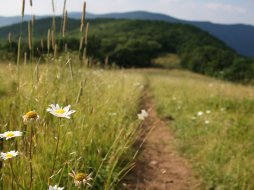
Chasteen Creek Trail
Categories: Play, Hiking & Backpacking, Fishing, Horseback Riding, Places of Interest, Backcountry Camping, Fishing for Wild Trout, Back Country Horse Trails, Great Smoky Mountains National Park... NC
Highlights
- Excellent Horseback Riding, Camping & Hiking Trail in Great Smoky Mountains National Park, NC Smokies
- 'Chasteen Creek Cascades' make for a nice stopping point in your hike
- Easily accessed from the Oconaluftee Visitor Center entrance to the park via Cherokee, NC & Smokemont Campground
- A nice population of small rainbow trout live in Chasteen Creek up to the cascades, then brook trout start to emerge above
- Backcountry campsite #50 is easily accessed 0.1 mile from the trailhead- this site requires reservation
(more info on reserving this site here or call (865) 436-1231) - Chasteen Creek Trail, paired with Bradley Fork Trail & Smokemont Loop Trail make for a nice loop hiking and backcountry camping adventure
The Local Scoop
Chasteen Creek Trail in Great Smoky Mountains National Park is a trail we recommend for hiking, fishing, backcountry camping and horseback riding.
Access this Smoky Mountain hiking trail from Smokemont Campground's hiker parking area, located at the very back of the campground (see local directions).
Here, you'll notice a small brown national park trail sign reading, "Bradley Fork Trail." You will also notice that the "Chasteen Creek Trail" is located an easy 1.2 miles from where you stand.
When you come to the trail head for Chasteen Creek Trail, you will have just crossed over Chasteen Creek. As you take the trail to your right (off of Bradley Fork Trail) you will notice it is fairly rocky. You can expect this for a good ways up to where you will access the cascades.
Backcountry Camping
After only 0.1 mile up Chasteen Creek Trail, look to your right for a small but noticeable side trail. This leads to Backcountry Campsite #50, a large campsite with 3 separate areas in which to camp, by reservation ONLY ((865) 436-1231). Chasteen Creek rushes beside the campsite, making for a peaceful and relaxing campsite. Plenty of water here and if you needed to get back to your car, it's only 1.3 miles away. Great spot for beginners to experience the wonders of camping under the stars in the Smoky Mountains.
Cascades
As you work your way up the trail, you'll cross the creek via wide bridge. A steady little climb is ahead of you through some gorgeous forest surroundings. At approx. 0.4 mile from the trail head you'll come to a fork in the trail. Take the left fork up to a horse tie up area. Continue straight ahead past the 'tie ups' and pick the trail up again. You can hear the cascades from here.
We recommend sitting on the log and taking in the lush surroundings while relaxing to the rush of the cascades.
Fishing
If you plan on fishing in this area be sure to have a valid NC or TN fishing license on you at all times. This is a heavily patrolled area of Great Smoky Mountains National Park and your chances of running into Park Rangers are good.
If fishing in Chasteen Creek, don't expect to catch many fish over 5 inches or so. You can catch some bigger trout in nearby Bradley Fork.
The Local Directions
From downtown Cherokee, NC take U.S. Hwy-441 North towards Great Smoky Mountains National Park for 6.6 miles. Here, you'll need to take a right onto "Smokemont Campground and Riding Stables Road." There will be a brown signs before you get to the turn. You will immediately cross a bridge over the Oconaluftee River. Go left once you make it over the bridge to access Smokemont Campground and parking for Chasteen Creek Trail access.
You'll need to find Sections D-F in the campground's multiple loops. This is easily done by keeping straight and bearing to the right as you work your way by the Forest Ranger Station, information kiosk, etc. You can't miss the 10 or so parking spots at the backside of the campground and where the Bradley Fork Trail head is located (gate across Forest Road/Trail).
From here, Chasteen Creek Trail is 1.2 miles along the easy roadbed.
- Coordinates
- 35.57699, -83.31330
- Access
- Moderate via Bradley Fork Trail
- Hike Distance
- To trail head: 1.2 miles
To Backcountry Campsite 50: 0.1 mile
To Cascades: 0.4 mile - Trail Distance
- 4.4 miles
(Bradley Fork Trail to Hughes Ridge Trail) - Nearest City
- Cherokee
- County
- Swain County
- Distance From
- Cherokee: 7 miles


