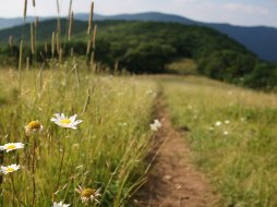
Chattooga River Cliffs Trail (lower)
Categories: Play, Hiking & Backpacking, Dog Friendly Hiking Trails, Fishing for Wild Trout, Swimming Holes
Highlights
- Lower end of the trailhead
- Immediate views of the "National Wild & Scenic" Chattooga River from the parking area and along the trail
- Swimming and wading (caution with children), we recommend doing this at least 200 yards above the main cascade at the "Iron Bridge"
- We recommend hiking the trail along the river as far as you like then turning around instead of hiking all 6.25 miles
- Headwaters of some of the best Whitewater around although off-limits to water sports
- "Wild" trout fishing above bridge and "Wild/Natural Bait" trout fishing below the bridge
- Great place for photos
- Primitive camping nearby at "Ammons Campground" as well as a few random roadside spots off of Bull Pen Road
The Local Scoop
The lower trailhead of the Chattooga River Cliffs Trail is a great place to take a family or spend the day with someone special. The trail is over 6 miles in length, but can be done in sections if you're willing to turn around head back the way you came. There is a "loop" section of this trail that is 2 miles in length called the "Chattooga River Loop Trail." You can access this section at just under 1 mile into the trail. There will be a sign at a switchback that heads up the hill and this will take you back to the parking area.
Take advantage of the river in summertime by taking a dip in numerous swimming holes in the area. When the water is lower in the Summer months, the sandy shores are exposed and provide a nice lounging area for visitors to use. You'll also want to know that the Brown Trout in this river can grow very large, so go buy your N.C. Wildlife Fishing License before you come, and try your luck at some fantastic fly fishing conditions. There are numerous fly-fishing guide services in the area to provide assistance if you or someone in your group is inexperienced. We recommend this trail to anyone looking for a private and peaceful hike along one of the most Wild and Scenic rivers around. Spend the day along this trail and take full advantage of the activities this river offers by hiking, fishing, swimming, picnicking, photo, etc.
Note: If you do decide to fish this river, keep in mind that there are many sections of this river that are not fishable and can be very dangerous especially if a heavy downpour of rain happens. Use extreme caution when wading this river.
The Local Directions
From main intersection of U.S. Hwy-64/ N.C. Hwy-28 in Highlands, NC drive through main street until the road turns into Horse Cove Road (just past Mtn. Fresh Grocery on your Right). Drive for 4.5 miles down into the cove via approx. 39 curves. Continue until you come to a fork in the road at a Brown mileage sign. Take the Right onto "Bull Pen Rd." for 3 miles to the trailhead at the Chattooga River and Iron Bridge. There is parking along the roadside and at the trailhead.


