 |
Chattooga River Loop TrailCategories: Hiking & Backpacking, Picnic Areas, Fishing for Wild Trout, Swimming Holes |
|||||||||||||
| ||||||||||||||
- Hike6
- Fishing6/8
Highlights
- Loop Trail great for anyone
- Trail follows the river for approx. 1 mile
- Swimming, Fishing and Hiking opportunities
- Picnic Table mid-way (past switch-back)
- Kid Friendly area but use caution with smaller kids around the large cascades near the "Iron Bridge" and trailhead
The Local Scoop
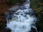
The Chattooga River Loop Trail is a great hike for the entire family. It's moderate in difficulty with a few inclines and obstacles to deal with (fallen trees over trail, wet spots, rocky/root exposure). You'll start at what locals call the "Iron Bridge," where you'll park. The trailhead for the "Loop" starts on the left side of the bridge and runs along the river for just under 1 mile. You can break up this 2 mile loop by stopping along the shores of the river for a picnic, swim or try your luck at fishing. There will be a sign for the remaining "loop" when you've been hiking for almost a mile. This sign is at a predominant switchback in the trail as it heads Left and up the ridge (if you continue to the Right you will be in for long hike on the Chattooga River Cliffs Trail (upper/lower), avoid this). A picnic table can be found midway through the hike if you would rather wait to have lunch here. The trail continues on until it joins back up with Bull Pen Road. You will take a Left here and head back to parking area. We recommend this trail to the entire family due to it's shorter length and activities to do while in the Highlands area.
Local Directions
From main intersection of U.S. Hwy-64/ N.C. Hwy-28 in downtown Highlands, NC drive straight through Main Street and the road turns into Horse Cove Road (just past Mtn. Fresh Grocery on your Right). Drive for 4.5 miles until you come to a fork in the road at a brown mileage sign. Take the Right onto the gravel/paved "Bull Pen Rd" (SR 1178) for 3 miles to the trailhead at the Chattooga River and Iron Bridge. There is parking along the roadside and at the trailhead.
