Devil's Courthouse Trail - Whiteside Mountain
Categories: Hiking & Backpacking
Highlights
- Great views of the Cashiers, NC area & East including: Old Edwards Golf Club, Mountain Top Golf Club, Lake Glenville, "Rhodes Big View" overlook off of U.S. Hwy 64
- Strenuous hike down the ridge (Wet, Rocky & Steep)
- The trail has been allowed to grow over some since the Forest Service discourages hiking due to potential strong winds on the courthouse
- Spur trail off of Whiteside Trail
- Avoid Side Trails
- Wear appropriate clothing and shoes
- Recommended for only experienced hikers and those physically "fit"
The Local Scoop
Devil's Courthouse is a hike that we would recommend for the more adventurous hiker and not the beginner. The trail is rough and pretty wet in some of the steep areas making this hike fairly dangerous for an unexperienced hiker. Take your time with this hike, it isn't a long, but is strenuous nontheless. Allow for at least one hour round-trip.
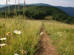
Once you get down the first segment (about a 0.3 mile), you'll come to a clearing and arrive at a "saddle". From here stay straight along the trail and back up a small incline on the other side avoiding side trails that split to the right and left of the saddle. From here, the trail ascends and bears right. around the corner. The trail works its way back to the left side of the ridge and ends at Devil's Courthouse. If you get to the "saddle" and you're confused just stick to the main path and try to work your way up and you'll pick up a definite trail around the left side of the courthouse. On a clear winter day look Northeast and you can make out Yellow Mtn. Firetower atop Yellow Mountain (5,127 Ft.), one of the last original look-out towers actually used for fire detection years ago. The view is beautiful, but be extremely careful, the sheer cliffs are straight down. If you deem it OK to bring children along, please pay attention to where they are at all times. The views from the courthouse are beautiful, but we wouldn't recommend this trail for children or the elderly. They can experience the views from "Whiteside Mtn Trail" much easier and safer.
The Local Directions
To Parking:
From the intersection of U.S. Hwy-64 East and U.S. Hwy-23/441 North in Franklin take Hwy-64 East towards Highlands, NC for 16.9 miles. In Highlands, go through the first redlight and continue up the gradual hill into town and through main street, staying straight to the next redlight and the intersection of U.S.-Hwy 64 and N.C. Hwy-28. Take a left, continueing on Hwy 64 East for approx. 5.7 miles to "Whiteside Mountain Road" on your right (It will also be the second entrance to "Wildcat Cliffs C. C."). Continue on Whiteside Mtn Rd. for exactly 1.0 mile to the entrance of the parking area for "Whiteside Mountain" on your left.
To Trailhead:
Take the Whiteside Mtn Trail, stay straight (avoiding the split trail to the right) for approx. 1 mi. until a predominant clearing and info sign for the valley below (this is on the left hand side of the first clearing. Whiteside trail continues up the mtn to the right). To access the Devil's Courthouse Trail, look directly past & below the Info sign, pick up the trail here. Stay straight on the trail which winds down to the courthouse. There will be side trails to avoid. (** see "Local Scoop" for detailed directions from here)


