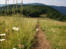
East Parking Area for Panthertown Valley
Categories: Hiking & Backpacking, Mountain Biking, Dog Friendly Hiking Trails, Backcountry Camping, Hikes to waterfalls, Fishing for Wild Trout, Swimming Holes, Panthertown Valley
Highlights
- One of two main entrances to Panthertown Valley
- Closest access (or shortest hiking distance) to the popular "Shoolhouse Falls"
- Direct trail access for Hiking or Mountain Bike: Mac's Gap Trail #482, Panthertown Valley Trail #474 East & Greenland Creek Trail #488 (Hiking Only)
- Panthertown Valley is a multi-use (Hike, Horse or Bike) area that offers some of the best backcountry activities around
- Best entrance to the valley for folks coming from Asheville/East
The Local Scoop
We recommend the "East Parking Area for Panthertown Valley" for folks that might be coming in from Asheville (or anywhere East of that) via U.S. Hwy-64. Also, we would like to suggest using this area for access to the popular Schoolhouse Falls. Schoolhouse Falls offer a very large pool for swimming or fishing in, a nice beach area for lounging or if you would like to venture behind the falls for a truly unique view, we recommend it!
This parking area also offers immediate trail access to Mac's Gap Trail #482, Panthertown Valley Trail #474 or Greenland Creek Trail #488. As mentioned in the highlights portion, the Greenland Creek Trail is only accessible by hike, no horses or bikes permitted. The Mac's Gap Trail is open for biking and hiking. This is the first trail you'll notice on the left when turning into the parking area. This trail runs along the southern portion of the valley and in between Big Green Mountain and Little Green Mountain. The Panthertown Valley Trail will take you through the heart of the valley and shares the creek bank with the Panthertown Creek for approx. 0.6 mile, offering a nice sandbar along the way for relaxing by the creek. Pick this trail up at the far right end of the parking area (same side as the info kiosk). The Greenland Creek Trail starts at the old iron gate at the end of the East parking area and heads down towards Greenland Creek. At 0.4 mile into your hike you'll notice Greenland Creek down and to your right, where "Mac's Falls" and "Pothole Falls" are located. I will have more info on these two falls soon.
Note: You can take either Greenland Creek Trail or Mac's Gap Trail from the East parking area to reach Greenland Creek Falls. The trails merge once you reach the creek, with Mac's Gap Trail continuing for a short distance along the creek, then crossing the creek and continuing on through the valley.
There is another set of falls, "Carlton Falls" on up stream from Greenland Creek. You will have to access the "unofficial" trail to access these falls though. This trail is located to the left of the base of Greenland Creek Falls and will take you approx. 30 minutes to get there. More info on both Greenland Creek Falls & Carlton Falls to come soon.
For more information on hiking/biking/horseback riding trails, waterfalls, backcountry camping, fishing in this area, visit our Panthertown Valley "Places of Interest" page.
The Local Directions
From Cashiers, NC take U.S. Hwy-64 East towards Brevard or Asheville, NC for 12.7 miles to the junction of NC Hwy-281 and U.S. Hwy-64. Take NC Hwy-281 North for 3.6 miles to "Cold Mountain Road" on your left (just past Lake Toxaway Fire House on the right). After taking the left onto Cold Mountain Road, continue along the twisting turns as you work past numerous lake homes and their drives and up the mountain. At 5.6 miles since you left NC Hwy-281 you'll see private property and a gated drive on the right, avoid this. To the left and uphill is the gravel access road to the valley, here is where you'll see the sign for Panthertown Valley. This will be the first sign of any sort you will see for the valley. After approx. 0.1/0.2 mile up the gravel road, it will fork again. Take the right and onto the access road to the East Parking Area. Note: This road had a large mud puddle in the middle of it the last time I was there. I had to park my car to the side and walk the short distance to the main parking area, about 0.1 mile. No problem.
From Asheville, NC take U.S. Hwy-64 West toward Brevard, Cashiers, Lake Toxaway. Nearing Lake Toxaway take N.C. Hwy-281 North (on your right) for 3.6 miles to "Cold Mountain Road" on your left (just past Lake Toxaway Fire House on the right). After taking the left onto Cold Mountain Road, continue along the twisting turns as you work past numerous lake homes and their drives and up the mountain. At 5.6 miles since you left NC Hwy-281 you'll see private property and a gated drive on the right, avoid this. To the left and uphill is the gravel access road to the valley, here is where you'll see the sign for Panthertown Valley. This will be the first sign of any sort you will see for the valley. After approx. 0.1/0.2 mile up the gravel road, it will fork again. Take the right and onto the access road to the East Parking Area. Note: This road had a large mud puddle in the middle of it the last time I was there. I had to park my car to the side and walk the short distance to the main parking area, about 0.1 mile. No problem.


