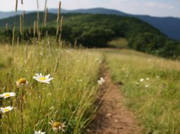
Ellicott's Rock Trail
Categories: Hiking & Backpacking, Museums & Historic Sites, Backcountry Camping, Dog Friendly Hiking Trails, Fishing for Wild Trout
Highlights
- Hiking trail only (bikes, horses & atv's are prohibited)
- This wilderness area spans over 9,000 acres
- Leads down the Chattooga River Gorge, to the Chattooga River
- Offers great Hiking, Primitive Camping and Fishing
- Hike to where N.C., S.C. & GA meet on the Chattooga river
The Local Scoop
Take the Ellicott Wilderness Trail to the Chattooga River and "Ellicott's Rock." This area covers over 9,000 acres covering parts of N.C., S.C. and GA. We recommend this trail to more experienced hikers & families. When the river is in view, you'll notice a more narrow trail that goes off to the left and steeply down the gorge, AVOID this trail, especially if you have smaller children. Allow for plenty of exploring time once you arrive at the river and it's West bank. This river offers great trout fishing, so you may want to pack some fishing equipment with you, as well as some river shoes, picnic lunch and towels/change of clothes.
To access and see Ellicott's Rock you will need to "ford" the river (which means cross) to the East bank. Once across, be sure to look for a wide flat area on the East bank which is actually a nice backcountry campsite. This is where "Bad Creek Trail to Ellicott & Commissioner Rocks" meets the river from the other Ellicott Rock Wilderness access point closer to Cashiers, NC. Here, you can pick up the trail that runs down river just past the campsite. Look for a brown sign with "Ellicott Rock" and an arrow pointing down river and follow it. In another couple of minutes you'll see a bright yellow sign with "Ellicott Rock" and an arrow pointing down the bank. Here, you will find Ellicott's origial carvings "N G", for North Carolina-Georgia and just above where you'll find Commissioner's Rock, approximately 15 feet apart. I should mention, these aren't "easy" to find. It will take some searching but they are there. However, if the water level is higher than normal, it will be next to impossible to find/see them. Be aware of the river's conditions before setting out on this hike. It would be a good idea to pass the trailhead and go down to the "Iron Bridge" to check the water level of the Chattooga River before you start.
Andrew Ellicott surveyed this area back in the early 1800's and carved the "N G" in 1811 to originally mark where NC and GA met to settle a dispute between the two states on where the border should be. He ended up finding that the border should be several miles South of where the Georgians claimed it was to be. Considering Ellicott was hired by the State of Georgia to complete the surveying, they didn't receive this information with open arms, and in turn denied Ellicott his pay. This trail is not only beautiful and adventurous, but it holds a lot of historical value to our area. This hike and exploration should be considered a "day trip."
The Local Directions
From main intersection of U.S. Hwy-64/ N.C. Hwy-28 in Highlands, NC drive through main street until the road turns into Horse Cove Road (just past Mtn. Fresh Grocery on your Right). Drive for 4.5 miles until you come to a fork in the road at a Brown mileage sign. Take the Right onto "Bull Pen Rd." for 2 miles to the entrance to Ellicott Rock Wilderness and the trailhead.


