Hurricane Creek Loop #36
Categories: Horseback Riding, Back Country Horse Trails
Highlights
- Follows old grassy logging roads
- 3 creek crossings
- Wildlife Viewing
- Great trail for beginners and/or training young horses
- Mountain views as you wind through the forests
- Camping and room for trailers at nearby Hurricane Creek Primitive Campground & Horse Camp
- Suitable for all riders with some experience
- Horse Trails marked with "Orange Blazes"
The Local Scoop
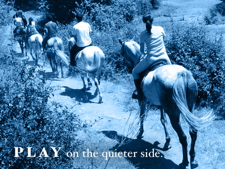
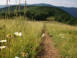
Hurricane Creek Loop follows old and grassy logging roads and is marked with orange blazes. The Trail passes examples of forest management and offers good opportunities for viewing wildlife as it gains an easy elevation. As you climb, the views of the Standing indian Basin are long range and fantastic. This trail is ideal for beginners as well as for training young horses. You will cross Hurricane Creek 2 times and a smaller branch once. This ride should take you approx. 2.5 to 3 hours. We would also like to mention that the Standing Indian Campground (located nearby) has a small supply store offfering some camping essentials as well as a pay phone in case of emergency. The store is only open during camping season.
The Local Directions
From intersection of U.S. Hwy-64 W and U.S. Hwy-23/441 North in Franklin take Hwy-64 W towards Murphy, NC for 12 miles. At just before the 12th mile you should see a Brown sign for "Wallace Gap", "Appalachian Trail" & "Standing Indian Campground" with arrows pointing you towards West Old Murphy Road(SR 1448) on your left. Stay on W.Old Murphy Rd. for 2 miles. You'll pass a Nantahala National Forest Sign for the campground saying "500 Ft Ahead", and at 2 miles you'll be at FR (Forest Road) #67 to your Right (indicated by a small, skinny Brown sign at the beginning of the road). Continue 1.8 miles on FR 67 until you come to a fork in the road. To your Right will be the entrance to "Standing Indian Campground", avoid the Right and continue on FR 67 to the left. In about 0.3 miles the road will turn to gravel at the Backcountry Info Kiosk. The trailhead is on FR 67 about 1.7 miles beyond the pavement break. Look for brown signage on the roadside.
- Distance From
- FROM (Town): Franklin, 17.8 miles RIDE: 4 miles
- Coordinates
- 35.0615, -83.4874
- Address
Franklin, NC 28734- County
- Macon County
- City
- Franklin


