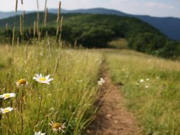
Panthertown Creek
Categories: Play, Fishing, Fishing for Wild Trout, Panthertown Valley
Highlights
- Wild Trout Catch & Release Only
- Single Hook/Artificial Lures Only
- Creek is roughly 3 miles long to the confluence with "Greenland Creek" creating the headwaters of the "Tuckasegee River"
- Native Brook trout
- True backcountry fishing with backcountry camping available throughout "Panthertown Valley"
- Elevation 3110 feet
- We suggest that you download and print the PDF map we provide for this area before visiting
The Local Scoop
There are some nice runs as well as pools located here for you to try your luck at catching a Native Brook trout which is in my opinion the most beautiful sport fish one can catch. It is also the ONLY "Native" trout to our area. Please repsect these waters as "Catch & Release" and by using single-hook artificial lures only. A tip that is extremely beneficial to both the fish and future anglers for Catch & Release waters is to make sure that your hands are dipped into the water and completely wet before you handle the fish to "land" it. This will ensure that your dry hands don't remove the slimy layer of film that coats the trout's skin. This coating helps keep the fish healthy and prevents infection among other things and promotes healthy fish for future anglers to enjoy.
We strongly recommend the Panthertown Valley area to all. This area has multiple creeks, waterfalls, trails and backcountry camping making it one of the most versatile areas for outdoor recreation around. The trails have different designations including, Hiking, Horseback Riding and Mountain Biking.
Our recommendation on where to access the creek would be from "Panthertown Valley Trail #474 (West)." OR you could check out "Granny Burrell Falls" before fishing, then actually do some fishing around the falls and further down stream.
NOTE: We recommend researching the Panthertown Valley area before coming and also suggest not coming by yourself or without a map. This area is "wild" and the trail system is unmarked, you can get lost very easily if you don't know where you're going. Our best suggestion is to download and print the map we provide on this site, find the trail(s) you are interested in and plan out your day accordingly. You need to avoid any side trails you come across (and you'll come across a lot of them).
The Local Directions
From Cashiers, NC
From the main intersection of U.S. Hwy 64 and N.C. Hwy 107 in Cashiers, N.C. take Hwy 64 East (towards Brevard) for 2 miles to "Cedar Creek Road" on your left (crossing the Horsepasture River). Take Cedar Creek Road for 2.3 miles to "Breedlove Road" (S.R. 1121 or "State Road") on your right. There will be a sign for Panthertown Valley at the stop sign. Take the right and travel 3.3 miles to the end of the pavement for Breedlove Rd and where the rough, gravel road begins. You can either park here (if you have a low or nicer car) or you can proceed on rough gravel/mud road to West Parking Area for the valley. After you reach the West Parking Area for Panthertown Valley (via foot- 10 minute walk OR car- 0.25 mile), you'll come to a Info Kiosk with a map of the valley in it and a gate across the trailhead. Be sure to take a look at the map and correspond the trails and their #'s with the ones here in my local directions/scoop.
Find Panthertown Valley Trail #474 which starts at the West Parking Entrance at the iron gate. Head down hill for a total of 1.3 miles along the wide trail (passing two trail intersections) to where Panthertown Creek joins you on the right at a large sandbar.
The first intersection is three-way with Deep Gap Trail #449 on your right at 0.55 mile into your hike from parking, and the second intersection is four-way with Mac's Gap Trail #482 on your right and on your left is North Road Trail #453. Avoid both and continue straight ahead for another 0.5 mile to where Panthertown Creek joins you on the right at the large sandbar.
Alternate Route via Granny Burrell Falls
From the West Parking Area for Panthertown Valley, head down Panthertown Valley #474 for 0.8 mile (passing the Deep Gap Trail #449 intersection) to Mac's Gap Trail #482 on your right. Take Mac's Gap Trail for approx. 0.3 mile over Panthertown Creek via wide bridge and access the first trail on your right, "Great Wall Trail #489." Head a short distance up this easy portion of trail to multiple spur trails on your right for access to the Granny Burrell Falls area.
- Coordinates
- 35.16843, -83.01153
- Access
- Difficult via U.S. Hwy-64/
Cedar Creek Road/
Breedlove Road - Hike Distance
- 1.3 miles
- Nearest City
- Cashiers
- County
- Jackson County
- Distance From
- West Parking Area for Panthertown Valley,
1.3 miles
Granny Burrell Falls Access, 1.3 miles
Cashiers, 8.9 miles


