Picklesimer Rock house Falls
Categories: Hiking & Backpacking, Waterfalls, Backcountry Camping, Hikes to waterfalls, Dog Friendly Hiking Trails, Adventure Waterfalls
Highlights
- 1 mile hike roundtrip
- Very easy hike along old logging road
- Secluded hike would be a great adventure for families
- Very cool "Rock House" created by recessed granite underneath the 40 Ft. falls
- Rock house would be great shelter for night's stay of primitive camping
- Multiple primitive camping opportunities on the trail or at nearby "Blue Valley Campground"
The Local Scoop
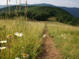
Picklesimer Rockhouse Falls is one of the more less known waterfalls in our area. There are no signs or mileage posts, so you'll have to pay close attention to our directions. The trail is an easy trek via an old logging road that winds it's way through a stand of Pine trees and on to a clearing where it looks like the forest service keeps it mown. Head straight through the clearing and on until ithe roadbed dead ends. Pick up the faint trail at the back of the old fire ring you should see in front of you. Take this trail for about 0.1 mile until you see the falls in front of you. We would recommend this Hike/Waterfall to those staying in Blue Valley Camprgound area, or just in the Highlands area for that matter. This hike is great for a family outing and the kids will love the cool "cave-like" aspect of the "Rock House". The waterfall is 40 Ft. high and it will depend on how much rain the area has had for the amount of flow over the edge. In a drought or dry season these falls could potentially be reduced to a trickle. This area was very clean when I went and it would be great if it continued this way. Please try to leave this area in better shape than you found it.
The Local Directions
From the intersection of U.S. Hwy-64 and N.C. Hwy-28 in Highlands, NC take Hwy-28 South towards Walhalla, SC for 6.3 miles. Here you'll see a sign for "National Forest, Blue Valley" with a tent icon on it, turn Right here. Continue down Blue Valley Rd. (S.R. 1618) for 0.5 miles where it will turn to gravel and F.R. #79 begins, keep going, you're on the correct road. From here, travel another 3.9 miles (passing F.R.#79C) to an old logging road on your Right. Your total mileage from Highlands is: 10.7 miles. Parking is very limited, but if you have a truck or 4x4 you should be able to pull up into the logging road entrance. Follow this old logging road for approx. 0.5 mile to a roughly mown clearing, heading straight through it to connect back to what looks like the logging road across the way and a dead end. From here, you're about 0.1 mile from the falls. Pick up a faint trail at the back/right of the dead end at an old fire ring. Head along the small creek and through the woods until you see the falls ahead of you.


