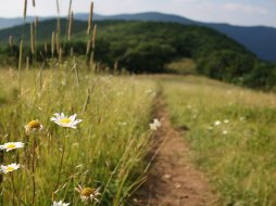
Wayah Road: Franklin to Nantahala-NC
Categories: Scenic Drives, Motorcycle Routes, Fall Foliage - western North Carolina
Highlights
- Beautiful drive up and over the "Nantahala Mountains" at Wayah Gap
- Multiple points of interest along this route: Hiking & Horseback trails, Picnic Areas, Shooting Range,
Fishing, Waterfalls & Camping - Appalachian Trail intersects Wayah Road at Wayah Gap
- Curves make motorcyclists and sports car enthusiasts happy
The Local Scoop
Recommended "POIs" or Points of Interest located along Wayah Road:
Note: We list POIs in order of their location, Franklin to Nantahala
- Arrowood Glade Picnic Area
- Rufus Morgan Falls & Trail
- Wilson Lick Ranger Station
- Wayah Bald Lookout Tower
- Wayah Crest
- Siler Bald #1 via Appalachian Trail
- Dirty John Shooting Range
- Forest Road 711 Horseback Trails: Rocky Bald Loop #631 & Winespring Loop #630
- Nantahala River-White Oak Creek to Powerhouse (below dam) Fishing
As you can see, there is so much to do along this route that we recommend taking your time and planning for at least an entire day to take in as much as you like. We suggest at a minimum, taking a picnic lunch or dinner to one of the multiple locations to picnic with our favorite being easily accessible, Arrowood Glade. Be sure to get in a hike with the easiest being the Wayah Bald Lookout Tower.
The Local Directions
From intersection of U.S. Hwy-64 West and U.S. Hwy-23/441 North in Franklin take Hwy-64 West towards Murphy, NC for 3.8 miles to "Old Murphy Rd.(SR 1448) on your Right (Wayah Bald sign). After you take the exit, continue down the hill for just under 0.2 miles to Wayah Road (SR 1310) on your Left ("Loafers Glory" gas station will be at the intersection of Old Murphy Rd. and Wayah Rd, so you'll know where to turn).
- Coordinates
- 35.161521, -83.456563
- Access
- Easy via U.S. Hwy 64 to
Wayah Road
-just outside of Franklin - Nearest City
- Franklin
- City
- Franklin
- County
- Macon County
- Distance From
- Franklin: 4 miles
Nantahala: 29.3 miles


